


Properly Plan for and Prolong the Need for Dredging with Bathymetric Studies
Lakes, ponds, and BMPs are beloved by communities for the beauty, functionality, and recreational space they add to populated areas, but without proper management and planning, the long-term care for these waterbodies can become expensive. Dredging, which is likely one of the largest expenditures a pond owner will ever face, provides the valuable removal of sediment in lakes and ponds that have accumulated runoff throughout their lifetimes. While dredging may take years to budget and plan for, data collection through bathymetry and sedimentation mapping can be used to more accurately determine the dredging needs of the waterbody and develop a more precise timeline for routine management.
For most waterbodies, a bathymetric and sedimentation study is recommended every three to five years to record the rate at which sediment accumulates over time. Lakes and ponds collect fertilizers, sediment, and other organic materials like pet waste, leaves, and grass clippings from roofs, streets, and sidewalks when it rains, and these materials can build up to several feet at the bottom of a waterbody until the structure can no longer retain the necessary volume of water. While dredging is often needed for older lakes or ponds, communities that use proactive management measures, like bathymetry to pinpoint the areas and rates of sedimentation, may be able to save money. They can use the bathymetric data to target small areas of concern before they become significant. By performing maintenance sediment removal on a more frequent basis, communities will spend a lot less money than if they wait for the sedimentation to get out of control.
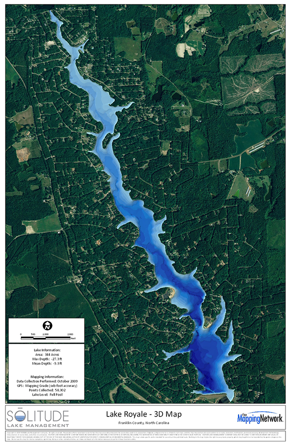
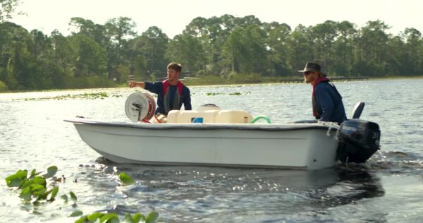
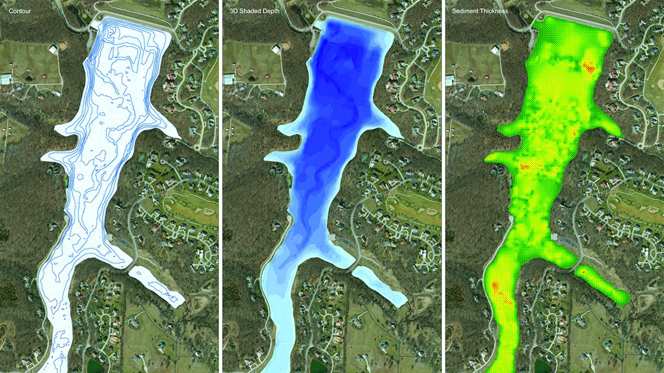
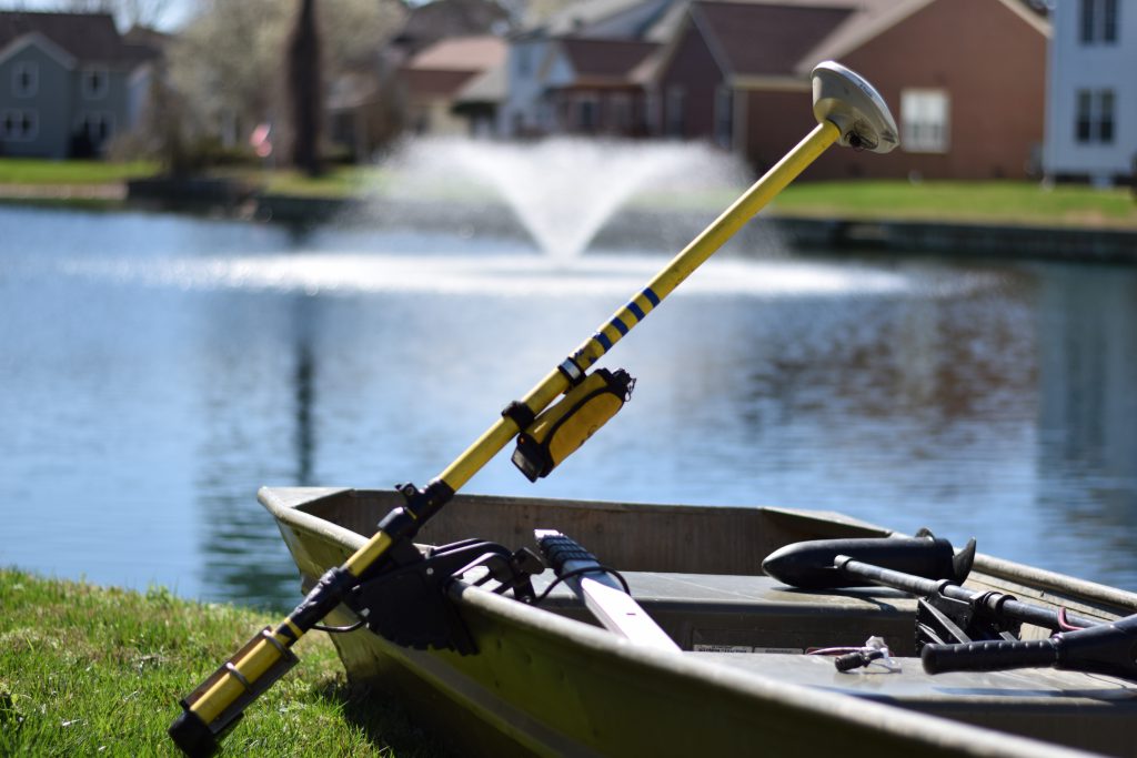
Bathymetry uses integrated depth-sensing technology to generate a detailed, three-dimensional model of a waterbody. The process relies on the collection of thousands of data points that are plotted across the surface of the water using a GPS device. Each of the surface points corresponds with the particular water depth at that plotted location. The resulting model exhibits highly accurate information about the waterbody’s various depths, bottom contours, and volume calculations.
Professional lake and pond managers can use this data to quantify the current maximum storage capacity of the waterbody. It can also be compared to the structure’s original design plans to analyze how much water has been displaced over time by accumulated organic materials, and predict when and how much must be removed in order to restore the waterbody’s original volume.
In addition to helping lake and pond owners calculate the impact of sediment on their waterbodies, accurate bathymetric and sedimentation data can be utilized to develop solutions for aquatic algae and vegetation issues, develop nutrient remediation plans, effectively install fish cover, and determine appropriate sizing and placement for submersed and floating aeration systems.
While dredging is an unavoidable necessity, it’s an intensive undertaking that can heavily impact the surrounding ecosystem and aquatic life. It also requires incredible planning, permitting and budgeting. Communities and pond owners interested in prolonging dredging should consult with a professional lake and pond manager to develop a long-term management plan, which includes bathymetry and sedimentation analysis, nutrient remediation, water quality analysis, vegetation management, and, when needed, hydro-raking services. These measures can not only enhance the aesthetic beauty of the pond, they may help limit the accumulation of sediment and extend the lifespan of the lake or pond over many years.
Lake Mapping with SOLitude
SOLitude Lake Management is committed to providing full service lake and pond management solutions that improve water quality, preserve natural resources, and reduce our environmental footprint. Our services include lake, pond, wetland and fisheries management programs, algae and aquatic weed control, mechanical harvesting, hydro-raking, installation and maintenance of fountains and aeration systems, water quality testing and restoration, bathymetry, lake vegetation studies, biological assessments, habitat assessments, invasive species management and nuisance wildlife management. Services, consulting and aquatic products are available to clients nationwide, including homeowners associations, multi-family and apartment communities, golf courses, commercial developments, ranches, private landowners, reservoirs, recreational and public lakes, municipalities, parks, and state and federal agencies. Learn more about SOLitude Lake Management and purchase products at www.solitudelakemanagement.com.