


What is Bathymetry? Depth-Sensing Lake Mapping Technology Explained
Anyone who’s had the opportunity to dive below the surface of a lake or pond knows that an entire world lies beneath the water. Full of unique creatures, aquatic plants, sediment, rock, crevices and more interesting finds, the bottom of your waterbody can reveal a lot about the health of the resource. Lake management professionals take this insight one step further using GPS mapping to help homeowners associations, municipalities, golf courses, fisheries, and private property owners determine the lifespan of their waterbodies, pinpoint problem areas, and budget for maintenance and repairs over time.
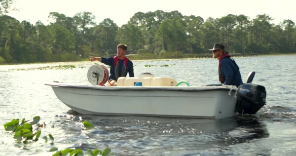
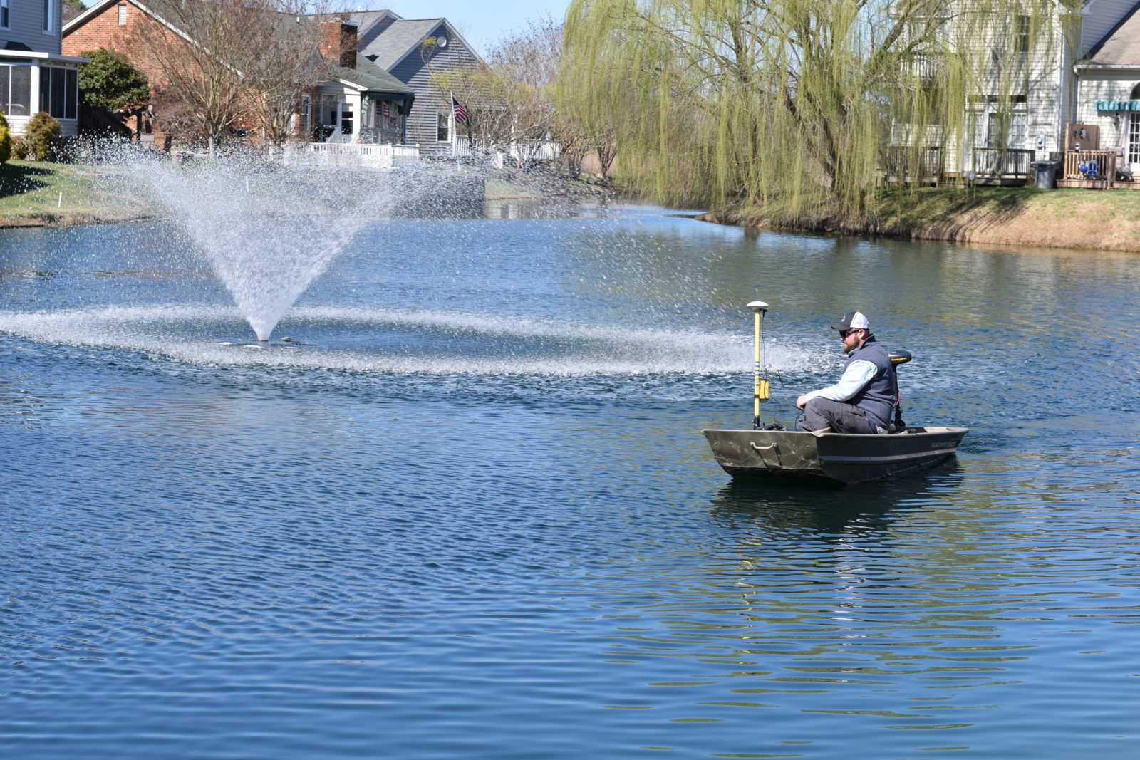
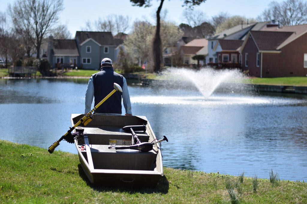
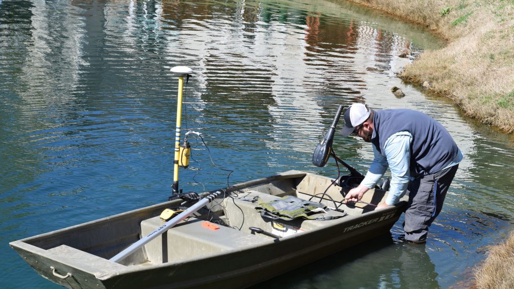
Through a process called bathymetric mapping, your lake management professional will carefully navigate the entirety of your waterbody while employing a specialized depth-sensing technology. After thousands of data points are collected, the information can then be used to create a three-dimensional model of your lake or pond that includes detailed bottom contours and highly accurate volume calculations. These models often provide insights that influence the management goals and plan for the waterbody and are recommended every three to five years to track changes over time.
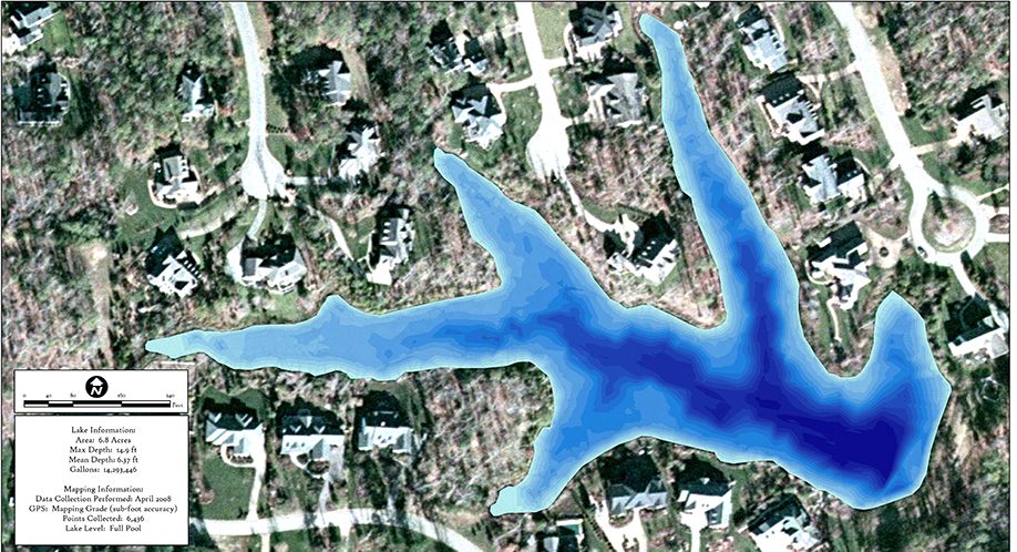
One of the most common data sets collected during a bathymetric study is the sedimentation rate. Lakes and ponds regularly collect runoff containing dirt, pet waste, leaves, fertilizer, grass clippings, twigs, and other nutrient-rich materials that decompose and create bottom sludge. Over the years, these materials can fuel nuisance plant growth and cause a significant decrease in water depth and the overall volume of the resource. Ultimately, dredging will be necessary to help restore lost depths, but mapping can make budgeting for dredging simpler and more accurate. Bathymetric data can also be used to measure the positive impact of proactive strategies used to safely remove muck and sediment, like hydro-raking and biological augmentation.
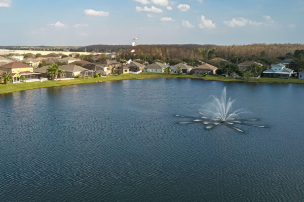
In addition to helping lake and pond owners calculate the impact of sediment on their waterbodies, bathymetric data also provides a window for the most effective sizing and placement of floating fountains and submersed diffused aeration systems. Armed with a clear look at the contours of the aquatic resource, your lake management professional can help ensure these systems have the best impact possible on the waterbody without interfering with stormwater parts or recreation.
Likewise, bathymetric data facilitates the proper placement of fish cover in trophy fishing ponds to help support growth and catch rates all season long. Successful pond managers maintain a healthy balance of cover relative to the overall pond size and depth. Too much cover will spread fish out, making it difficult for predator fish to feed and fisherman to catch. Too few will make it easy for predators to “gang up” on smaller fish. Fisheries with proper cover placement will be better positioned for success.
For stormwater management facilities and drinking water reservoirs, in particular, bathymetric mapping can help municipalities identify small problems before they get out of hand and cause costly and dangerous damages. Bathymetric data can help reveal blockages and structural damage to critical underwater infrastructure that may be contributing to unsafe conditions within the aquatic resource. Once identified, maintenance or repairs can take place.
Just as you refer to a map when traveling, bathymetric maps help point lake and pond owners in the right direction when it comes to developing an effective management plan that achieves their goal—whether that is to establish a thriving trophy fishery, create a relaxing spot or boating, encourage golfing and recreation, or develop a beautiful and healthy decorative pond that lasts a lifetime. Ultimately, the more knowledge your lake or pond manager has to manage your aquatic resource, the better equipped they will be to make your dreams come true.
Lake Mapping In Action
SOLitude Lake Management is a nationwide environmental firm committed to providing sustainable solutions that improve water quality, enhance beauty, preserve natural resources and reduce our environmental footprint. SOLitude’s team of aquatic resource management professionals specializes in the development and execution of customized lake, pond, wetland and fisheries management programs that include water quality testing and restoration, nutrient remediation, algae and aquatic weed control, installation and maintenance of fountains and aeration systems, bathymetry, mechanical harvesting and hydro-raking, lake vegetation studies, biological assessments, habitat evaluations, and invasive species management. Services and educational resources are available to clients nationwide, including homeowners associations, multi-family and apartment communities, golf courses, commercial developments, ranches, private landowners, reservoirs, recreational and public lakes, municipalities, drinking water authorities, parks, and state and federal agencies. SOLitude Lake Management is a proud member of the Rentokil Steritech family of companies in North America.