


Site Description
Location: Tamassee, SC
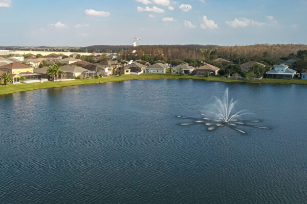
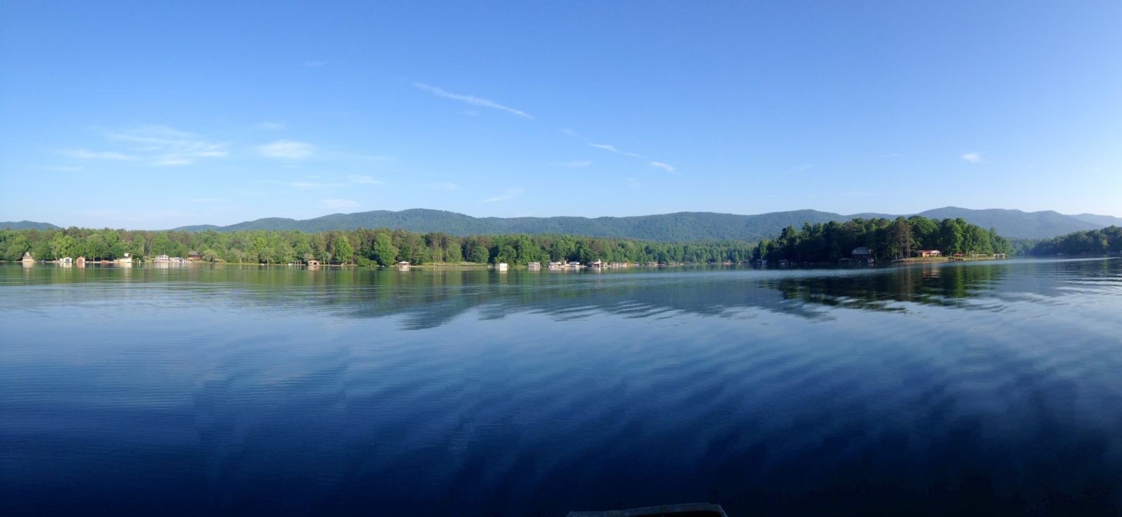
This waterbody is a 162.7-acre lake in western South Carolina. Many of the homes surrounding the lake are second homes with very few residents living on the lake year-round. A popular National Forest is adjacent to the lake, which contributes to the unique feel of the lake hidden in the northwest corner of the state with North Carolina and Georgia state lines within an hour’s drive. The lake is privately owned and is part of the neighboring lake’s watershed.
Scope of Work
Consulting services to determine the existing state of the lake and to form a baseline in regard to water depths, sediment load, water quality, and mercury levels. The residents were concerned with a few primary issues that included a potentially high mercury load due to gold mining activities that have occurred for many years upstream of the lake, older septic systems possibly failing, sedimentation, water quality issues resulting from all of the aforementioned concerns, and an overall assessment of the ecosystem health. Report findings to the Board of Directors and prioritize further assessment and monitoring to capture any change that may occur and indicate potential issues that could adversely impact the lake’s ecosystem and therefore the recreational and aesthetic value of the lake.
Project Description
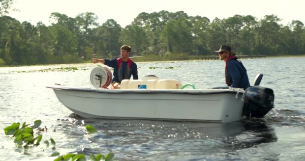
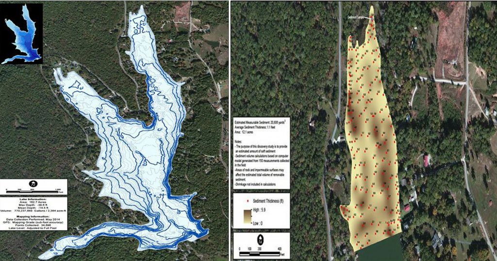
SOLitude Lake Management did a bathymetric study using United States Army Corp of Engineers methodologies to determine the existing depths of the 162.7-acre lake. Professional grade GPS, sonar transducer, and equipment were used for data collection. Contour maps were created from the data delineating the existing depths. Three influent cove areas were assessed to determine the existing sediment load. Sediment depths were recorded using a GPS and surveying measuring rod. The sediment depth was then extrapolated to determine the sediment volume in each influent cove area. The sediment calculations were used to convert the data collected into cubic yards to better understand the sediment load and to provide a rough estimate of estimated costs to remove and/or relocate the sediment.
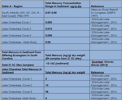
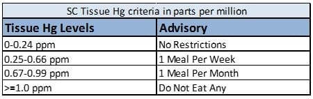
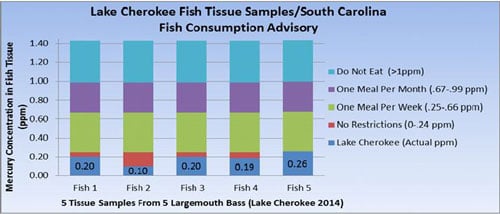
Five largemouth bass were collected via SOLitude’s electrofishing vessel and sent off to a laboratory for methylmercury testing. The data received was then compared to the 2010 Mercury Assessment and Reduction Initiative study performed by the South Carolina Department of Health and Environmental Control (SCDHEC). There was ample data available to compare the lake’s data to other lakes in the area and throughout the state of South Carolina. The data collected allowed the residents to see how the mercury levels in their lake compared to other state-owned lakes in the region.
Water quality tests were taken to establish a baseline for the lake and to potentially determine if any faulty septic systems were adversely impacting the water quality in the lake. E. coli was tested to determine if abnormally high fecal coliforms were present likely indicating a potential issue with septic systems failing around the lake. Sediment testing for phosphorous and nitrogen were also performed to help determine if sedimentation could be contributing to water quality degradation in the lake. Total Mercury was also tested in the sediment to determine if mercury contamination was able to be detected.